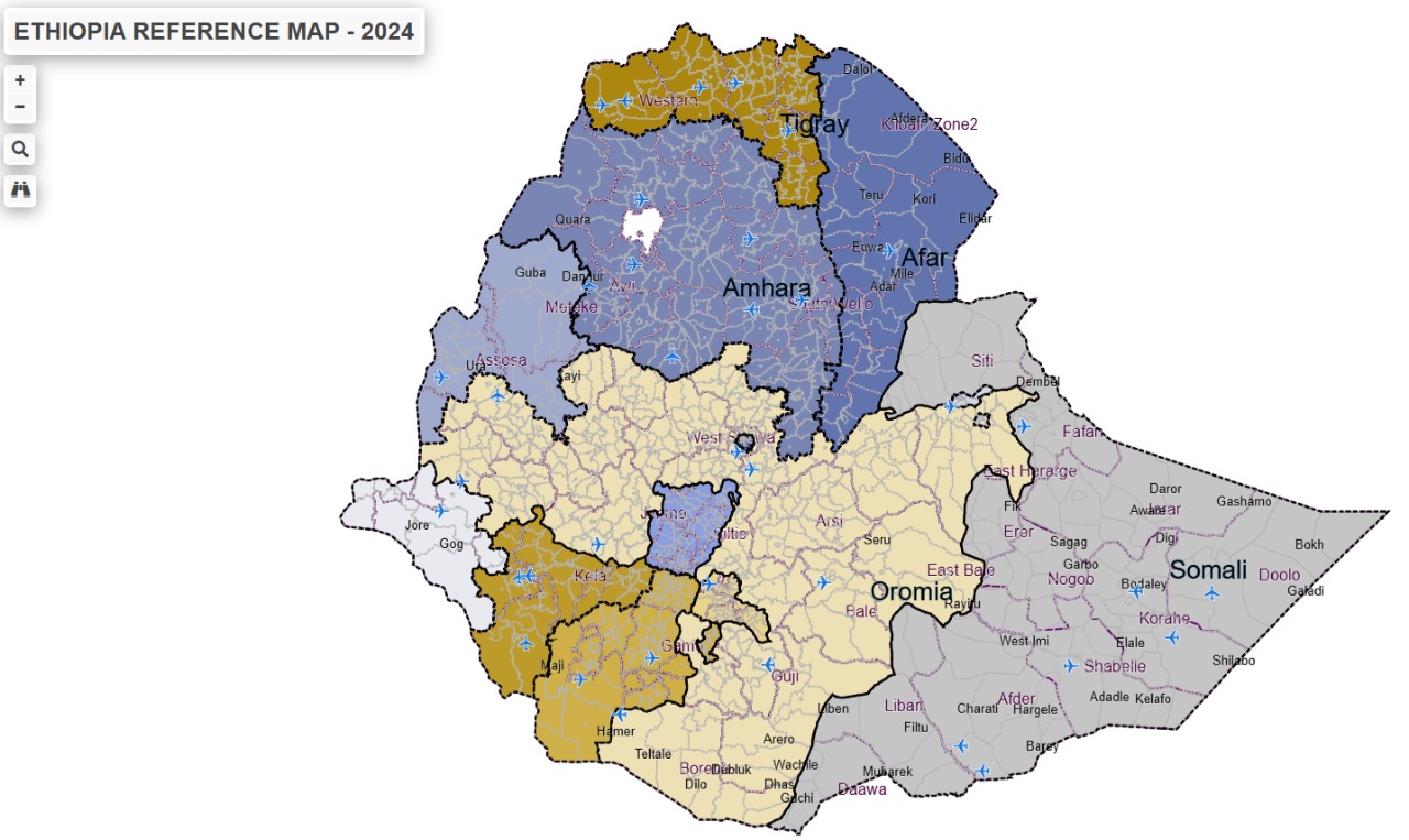
Ethiopia – Interactive Reference Web Map
LEBIZU is pleased to provide an Interactive Reference Web Map of the entire Ethiopia that enables users to access and visualize geographic information anytime and from anywhere through a web browser.
The platform serves as a convenient geographic reference tool, bringing together administrative boundaries and other publicly available spatial datasets in an easy-to-use online environment. It is designed to support users who need quick access to location-based information for planning, field operations, reporting, and general reference purposes.
Easy access to Geographic information
The Interactive Reference Web Map allows users to explore and visualize spatial information without requiring specialized GIS software. Through a simple and intuitive interface, users can:
- View administrative boundaries at various levels
- Search for specific locations, towns, zones, and woredas
- Visualize infrastructure and other available reference datasets
- Navigate across different geographic areas using interactive map tools
- Access spatial information from any location with an internet connection
The platform provides a practical way to understand where administrative areas and key features are located, making it useful for project planning, field preparation, coordination, and reporting activities.
Supporting field planning and operations
For organizations, researchers, consultants, and development practitioners, understanding geographic context is essential. The the Reference Web Map helps users quickly identify administrative areas and visualize available geographic information before field deployment and operational activities.
Whether preparing field missions, identifying project locations, or familiarizing teams with an area of interest, the map provides an accessible source of geographic reference information.
Accessible anytime, anywhere
As a web-based platform, the map can be accessed from desktops, laptops, tablets, and mobile devices without software installation. Users can conveniently search locations and explore available layers directly through their web browser.
Explore the Map
The Reference Web Map provides a simple and effective way to visualize geographic information and administrative boundaries online.
Visit the map today and explore locations, administrative areas, and available reference datasets through an interactive mapping experience.
Map access: Ethiopia – Interactive Reference Web Map
Disclaimer
The information presented on the map is compiled from publicly available sources and reference datasets. While reasonable efforts have been made to ensure data quality, LEBIZU does not guarantee the completeness, accuracy, or currency of all information displayed. Users are encouraged to verify critical information through appropriate official sources before making decisions.